
The Cols: Pyrenees
Col du Tourmalet
2,115M
The Tourmalet first featured in the Tour de France in 1910, when the race ventured into the Pyrenees for the first time. It was part of an enormous 326 km stage from Luchon to Bayonne. Just imagine riding that on the roads and bikes of the time! It's gone on to become the most frequently climbed mountain pass in Tour de France history, with 91 crossings by 2026. The Souvenir Jacques Goddet is awarded to the first rider over the summit when the Tour crosses the pass. At 2,115 m, it's also the highest paved mountain pass in the French Pyrenees.
Two distinct approaches.
BEFORE YOUR RIDE
| East | West | |
|---|---|---|
| Start | Sainte-Marie-de-Campan | Luz-Saint-Sauveur |
| Distance | 16.9 km | 19.1 km |
| Average | 7.4% | 7.4% |
| Character | Gentle opening, relentless upper section | More demanding from the start |
| resupply | La Mongie | Barèges / Tournaboup |
Note
Mountain weather can change quickly, both in temperature and conditions. Always carry a rain jacket, even in the middle of summer, and remember that a long descent can get cold very quickly. I tend to use a small 1.5-litre handlebar bag, which has enough room for arm and leg warmers, long-fingered gloves, a buff and a rain jacket. Check the mountain weather forecast and road conditions before setting off, including any closures affecting your route. The emergency number in France is 112.
EAST – SAINTE MARIE DE CAMPAN
This side was the original side used for the first 3 years when the Tour de France first ventured into the Pyrenees. The climb begins in Saint Marie de Campan right near the Eugêne Christophe statue (a good photo opportunity). There are normally public toilets and a water fountain right here as well as a couple of little restaurants. After you leave the start the next place to get water or food is La Mongie after 12.5km so make sure you have full bottles and some food when you start to climb.
The climb has an easier beginning pretty much until you get to the little hamlet of Gripp. Then after this the upper section stiffens up, but stays mostly around 7-9% although there's a sharp kicker near the summit where it touches 13% briefly so save a bit in the legs for the last 1-2km.
There are a couple of tunnels on this side, open-sided but I would still advise carrying a steady front and rear light (remember NOT flashing). While La Mongie is IMO an ugly ski resort it's a great landmark to aim for at 4.4km from the summit and of course an ideal opportunity to resupply if needed. After here there is nowhere to stop till the summit, so top up bottles and get food if you need to.
WEST – LUZ-SAINT-SAUVIER
From the west, the climb begins in Luz-Saint-Sauveur. This was the side Eugène Christophe climbed in the 1913 Tour de France, before breaking his forks on the descent towards Sainte-Marie-de-Campan. He had to walk down to the village and repair them himself in a forge, even receiving a penalty for a little help during the repair!
The climb feels like it's split into two halves. The first 6.5 km or so are a bit of a drag out of Luz, on a wide road with no real switchbacks for the first 4 km. It can be a bit of a mental game while you settle into the climb. The gradient kicks up as you pass through Barèges.
Food and drink are more readily available on this side, starting in the little square in Luz-Saint-Sauveur, then again in Barèges at around 7 km. One thing to note: when I visited, the fountain in the square wasn't drinking water, but I found a separate tap near a small parking area. Check that any water source is marked as safe to drink before filling your bottles.
Then there's the Tournaboup ski station at around 10 km. After that, it's a slog to the top. One final thing about the auberge at the summit: on my visits, the tap water wasn't drinkable, so I've had to buy bottled water from the bar, which also serves food. Don't rely on being able to refill your bottles for free at the summit.
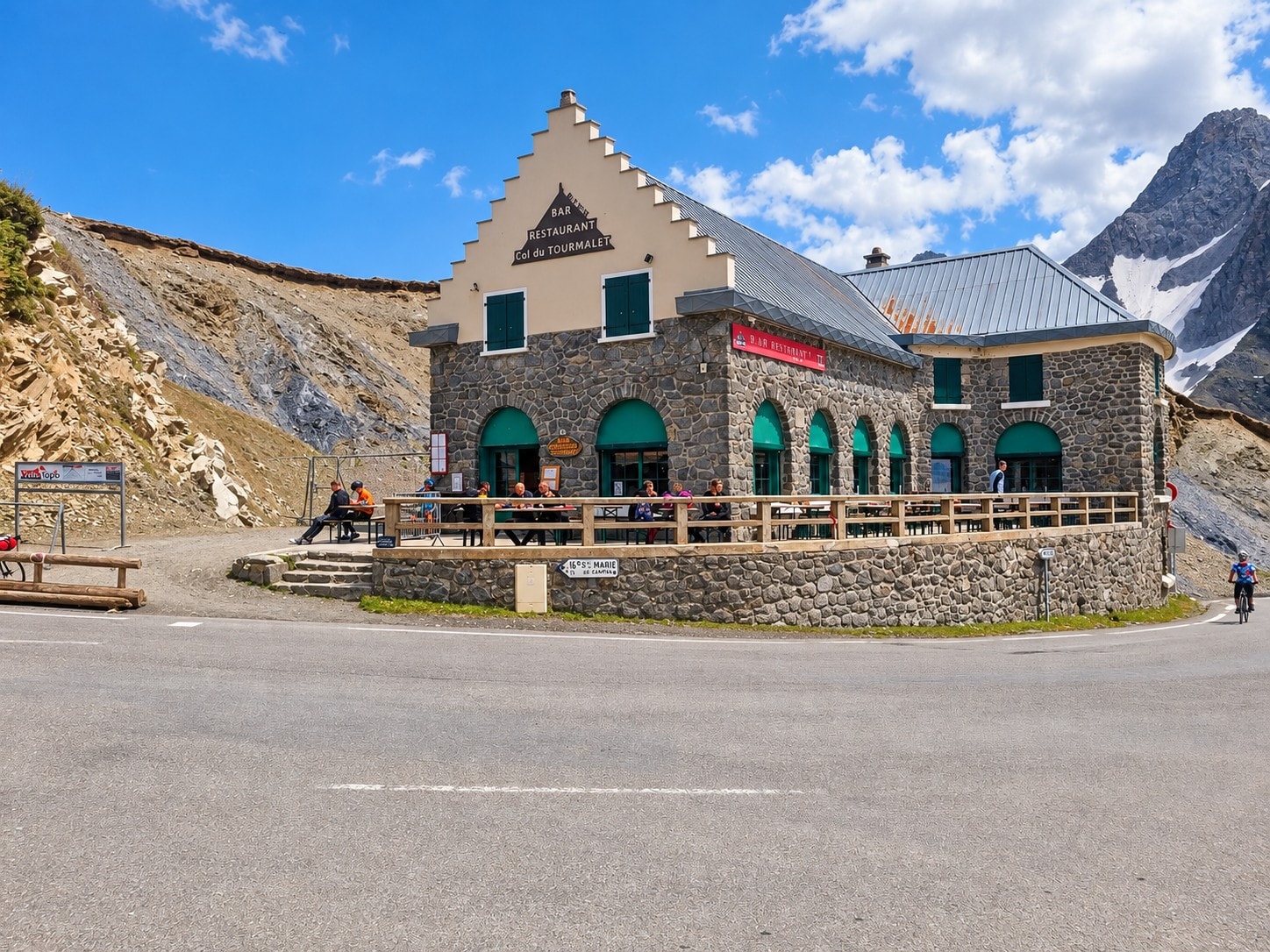
Auberge at the Tourmalet summit
FROM MY SADDLE
Now, you can slog up the D918 from Barèges if you want, following the route of the modern Tour de France.
But let me tell you a secret.
Just beyond Barèges before you get to Tournaboup - look out for a little green and white sign on your right: Voie Laurent Fignon.
It's the old road, closed to cars when I rode it in 2022 for the first time, and, in my opinion, a much cooler way to climb the Tourmalet. It takes you over the old Pont de Gaubie, with the stream flowing underneath. I've been known to stop, get off my bike and sit by the plunge pool near the bridge, feeling that cold, fresh mountain water flowing past me as I cool down. The climbing profile is slightly different along this route, as it rises above the D918 for a section. The elevation profile I've included here follows the main road, not the Voie Laurent Fignon. One thing to remember: the Voie Laurent Fignon is intended for climbing, so use the main D918 for your descent. Check local signs and conditions before riding it.
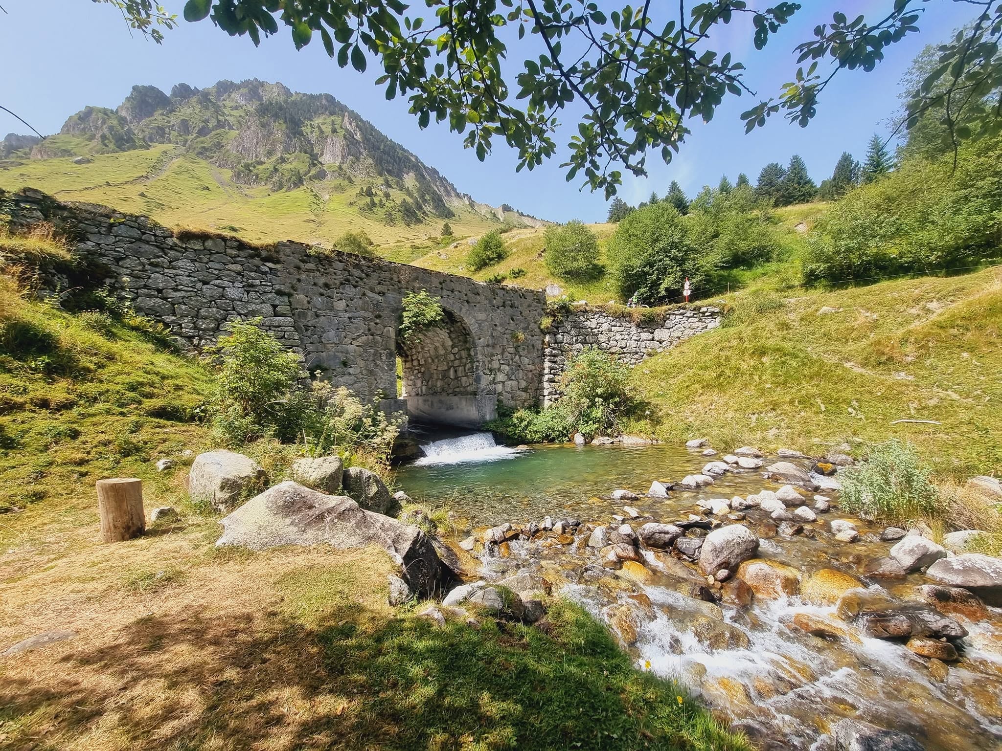
Bridge on the Voie Laurent Fignon
At the top of the Voie Laurent Fignon, you'll rejoin the main D918. There are no-entry signs to prevent cars coming down the old road, but keep your wits about you as you rejoin the main road. The difference between the quiet old road and the traffic on the D918 can feel huge! I wouldn't recommend descending the Voie Laurent Fignon. The surface can be rough, with loose stones and rocks, and that's not a good combination with descending at speed. It's primarily a climbing route, so check the signs and use the main D918 for the descent.
Oh, and one more word of caution. When descending back into Barèges, watch out for the one-way system through the village. On my visits, the route has taken me to the right and around the back of the square where the main water fountain is. Follow the current road signs rather than assuming you can ride straight through.
BEYOND THE SUMMIT
The amazing thing about the Tourmalet is how much fun you can have with it. Whether that's the very "cool" Laurent Fignon route or something else entirely, there are loads of ways to work this mountain into a bigger ride.
Loop Rides — There are plenty of possibilities using the surrounding valleys and neighbouring climbs.
Luz Ardiden — Another famous Tour de France climb, starting just outside Luz-Saint-Sauveur. Well worth adding if you've still got the legs!
The Three T's — Three huge climbs, all reaching over 2,000 m, combined into one serious challenge.
Pic du Midi gravel extension — For something completely different, there's the high-mountain route towards the Pic du Midi observatory at 2,877 m. This is a serious undertaking requiring suitable equipment, route research and careful attention to weather, terrain and access restrictions. Don't assume you can ride all the way to the summit.
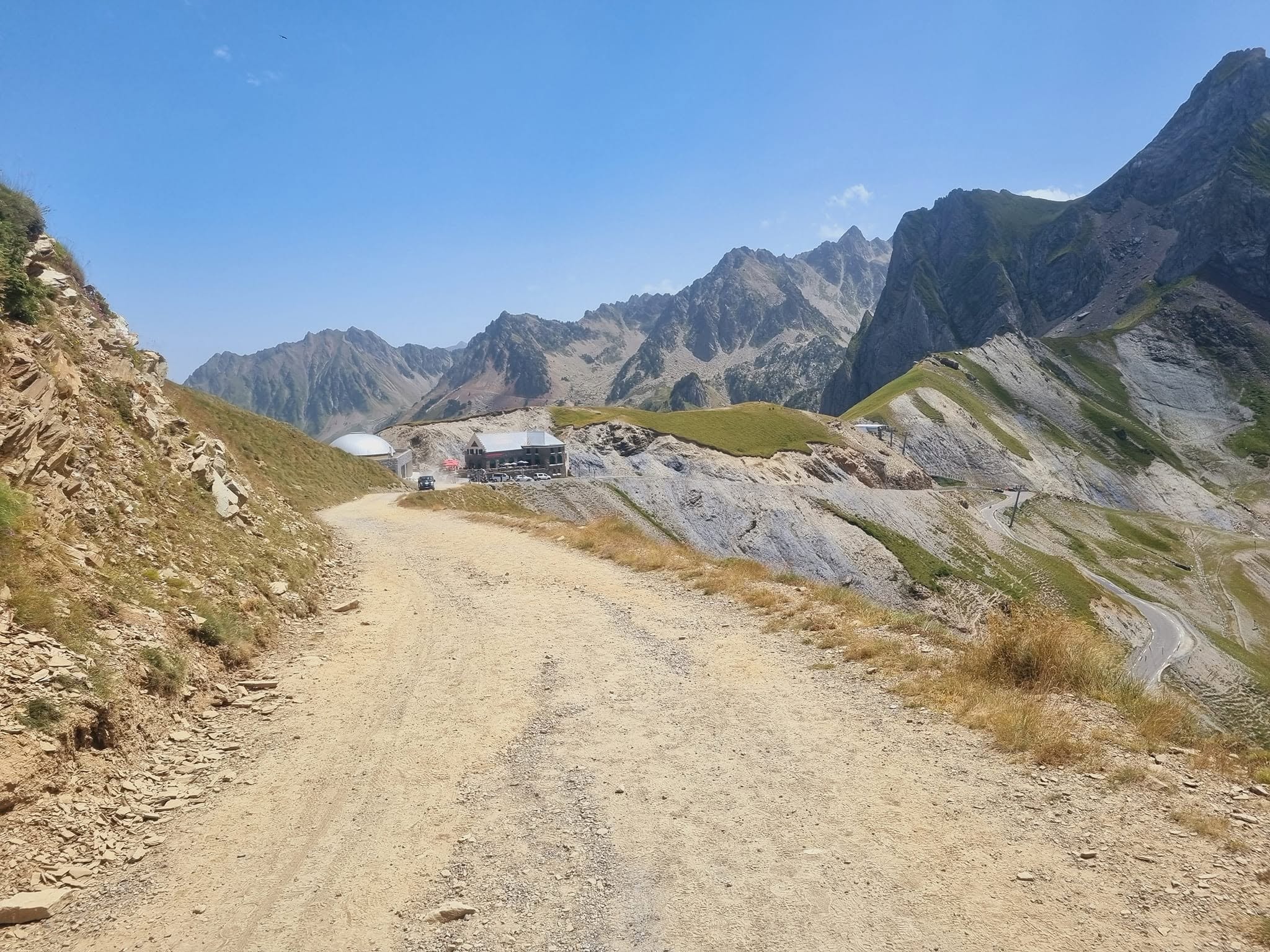
Gravel track beyond Tourmalet
There's more to this mountain than the gradient.
The Tourmalet played a significant part in my own journey from the sofa to the high mountains. That story runs through Triple Crown and The Pyrenean Spine, the first two books in The Cols of a Midlife Cyclist series.
If you've enjoyed this guide, take a look at the books, and discover the stories behind the climbs.